UN
9 Redfern Road
£ 450,000
Description
We don't have a Description for this property.
- Bedrooms
- 4
- Bathrooms
- 0


Leaflet © OpenStreetMap contributors
The heatmap indicates the level of crime in the area. The color of the heatmap indicates the crime severity and recency.
Metrics Year-on-Year
- Average area value
- 561,039.00 £Increased by 23.74 %
- Average area rental value
- 2,333.00 £/moIncreased by 27.35 %
- Est rental Yield
- 4.99 %Increased by 2.89 %
- Crime Rate
- 7.00 %Unchanged by 0.00 %
from 453,385.00 £
from 1,832.00 £/mo
from 4.85 %
from 7.00 %
Nearby Schools
| Name | Type | Ofsted | Distance |
|---|---|---|---|
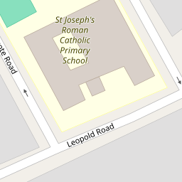
| St Joseph'S Roman Catholic Primary School | Voluntary Aided School | Outstanding | 0.22 KM |
| Curzon Crescent Children'S Centre | Children's Centre | 0.29 KM | |
| Curzon Nursery School & Family Wellbeing Centre | Local Authority Nursery School | Good | 0.33 KM |
| Leopold Primary School | Community School | Good | 0.42 KM |
| Maple Walk School | Other Independent School | 0.55 KM |
Images
Nearby Streets
| Name | Average Price | Average Sqft | Distance |
|---|---|---|---|
| Northcote Road | £ 399,950 | 0 | 0.00 KM |
| Fawcett Road | £ 900,000 | 0 | 0.00 KM |
| Suffolk Road | £ 560,000 | 0 | 0.00 KM |
| Roundwood Road | £ 700,000 | 0 | 0.00 KM |
| Church Road | £ 0 | 0 | 0.00 KM |
Nearby Transport
| Name | NLC | TLC | Distance |
|---|---|---|---|
| Harlesden | 1521 | HDN | 1.08 KM |
| Willesden Junction | 1457 | WIJ | 1.27 KM |
| Stonebridge Park | 1454 | SBP | 2.85 KM |
| Kensal Green | 1447 | KNL | 3.07 KM |
| Acton Main Line | 3000 | AML | 3.37 KM |
Nearby Listings
| Address | Price | Type | Score | Distance |
|---|---|---|---|---|
| 28a Redfern Road, Harlesden, London NW10 9LB | £ 160,000 | BUY | 3 / 10 | 0.03 KM |
| Redfern Road, Harlesden, NW10 | £ 625,000 | BUY | Unknown | 0.03 KM |
| Fortunegate Road, Harlesden, NW10 | £ 395,000 | BUY | Unknown | 0.05 KM |
| Fortune Gate Road, Harlesden , London, NW10 | £ 375,000 | BUY | 6 / 10 | 0.06 KM |
| Leopold Road, Harlesden, NW10 | £ 325,000 | BUY | Unknown | 0.08 KM |
Nearby Properties
| Address | Price | Distance |
|---|---|---|
| 33a Redfern Road | £ 195,000 | 0.00 KM |
| 27b Redfern Road | £ 170,000 | 0.00 KM |
| 65a Redfern Road | £ 160,000 | 0.00 KM |
| 9 Redfern Road | £ 450,000 | 0.00 KM |
| 23 Redfern Road | £ 145,000 | 0.00 KM |